|
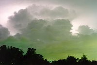
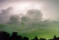
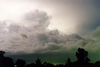
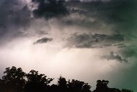
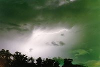
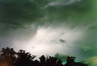
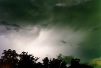
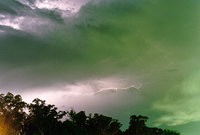
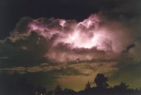
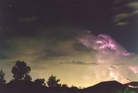
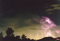
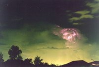
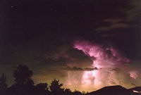
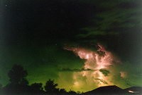
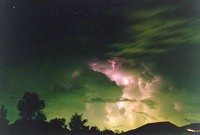
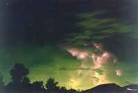
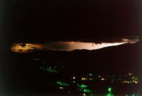
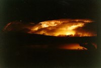
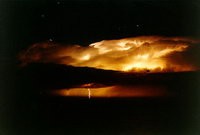
After an uneventful storm chase into the Blue Mountains earlier in the day, thunderstorm activity developed off the coast and moved inland FROM the northeast into the Sydney metroplitan area. Occasionally storms do move towards the west (as in this case), and are nearly always flash flood events. This storm was an exception as it gave winds to 120km/h, torrential rain (up to 70mm in one hour), blackouts and intense strobing lightning! Exposures for the glowing cloud shots were F2.8 and between 10 and 30 seconds. The last five were F4 and 30 seconds. Shots were taken from 9pm to 9.45pm on Friday 10th February 1995.
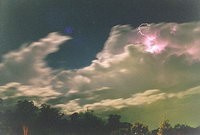
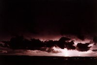
Weak convection throughout the afternoon and evening finally gave way to some fast moving electrical storms in the evening. I observed many bolts of lightning extending upwards into clear air above the storm, and captured a few on film. These were taken out the front of my house from 9.30pm Lens: 35mm, Exposures: F4, Durations: 5 - 30 seconds
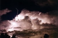
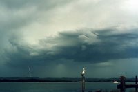
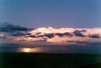
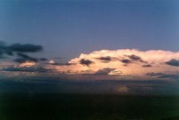
This storm gave some isolated heavy falls of rain to some suburbs of Sydney as it moved in from the southwest. I photographed this storm from the front of my house facing ESE. Stars are visible above the cumulonimbus. Lens: 50mm, Exposures: F4 (01-04), F8 (05-07), Durations: 15 to 30 seconds.
A severe thunderstorm with hail to 7cm diameter occurred about 40km west of here. The storm edged northeastwards with some interesting cloud formations and a lot of cloud to ground lightning. I managed to get this shot with a shutter speed of 1/60th. Ballina, NSW
Thunderstorms developed and spread across north eastern Victoria late on 18th January 1996. At about 11pm I decided to drive up to Huggins Lookout at Bright to get a better view of the distant lightning to our northwest. The activity was a little too distant but I took this shot anyway ! 20 seconds, F4
I was hoping for some lightning action this evening as a very large band of storms advanced into north-eastern NSW. Unfortunately, by the time it reached Ballina, most of the activity died out, although I did manage this one shot after waiting for the sun to set. F8, 5 seconds. The instability from this system remained in the region and spawned some great action the next day and night.
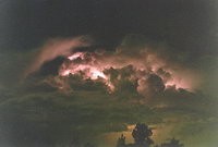
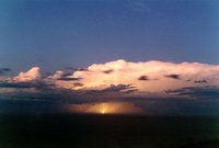
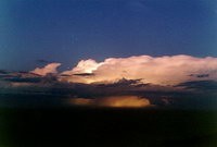
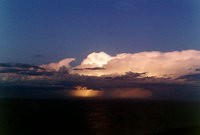
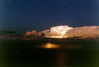
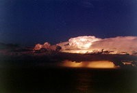
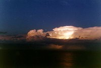
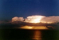
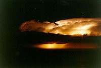
Spectacular hailstorms earlier in the day gave way to this nice storm off the coast, east of Cape Byron, NSW. All images were F5.6 - F4 and about 30 seconds exposures, except the last three pictures which were taken with a zoom lens at 80mm, all F4, 30 - 45 seconds.
|